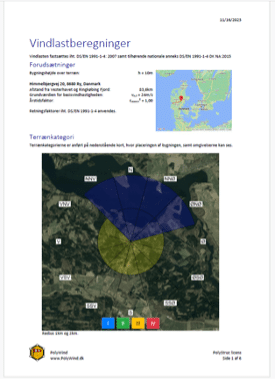
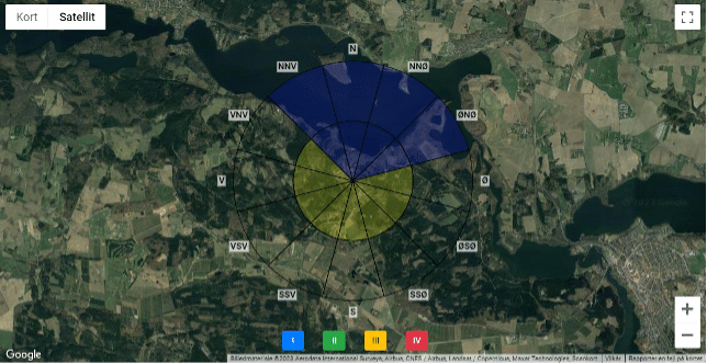
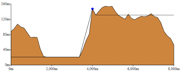
PolyWind uses two algorithms to determine the terrain categories. PolyWind divides the angle section into water, forest, urban area etc. in a radius of 2 km. It compares the areas to the regulations in Eurocode to get the terrain categories. An AI-image recognition algorithm is uses if there is not enough data available. It that case it uses images from Google Maps to determine the terrain categories.