Automatic determination of the basic wind velocity.
PolyWind evaluates the terrain categories based on typographic data.
Automatic determination of the orography factor based on the entered address.
Determine the shape coefficients for the most common building types.
Get a strong visual representation of your terrain categories, orography, and wind loads.
Document your wind loads in a short and precise PDF.
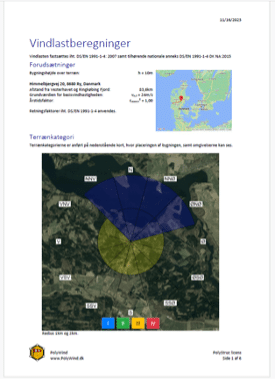
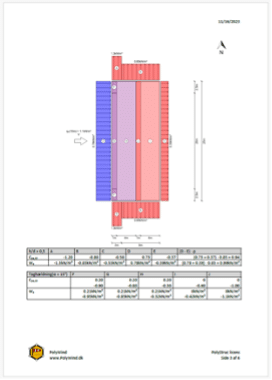
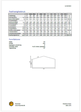
The primary aim of PolyWind is to improve the documentation of wind loads on structures. It aims to justify the terrain categories, orography factors etc. by backing up with data show. This allows for easy validation of the wind loads.
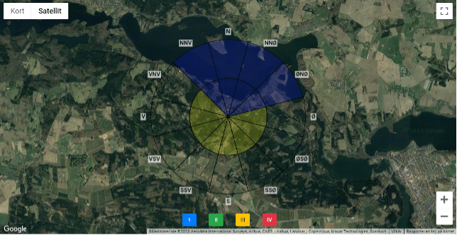
PolyWind uses two algorithms to determine the terrain categories. PolyWind divides the angle section into water, forest, urban area etc. in a radius of 2 km. It compares the areas to the regulations in Eurocode to get the terrain categories. An AI-image recognition algorithm is uses if there is not enough data available. It that case it uses images from Google Maps to determine the terrain categories.
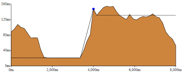
Even small hills can lead to increased wind loads. PolyWind considers this and calculates the corresponding orography factor. In Denmark, there is a tradition for ignoring the orography. This underestimates the wind load when building on small hills leading to unsafe designs.
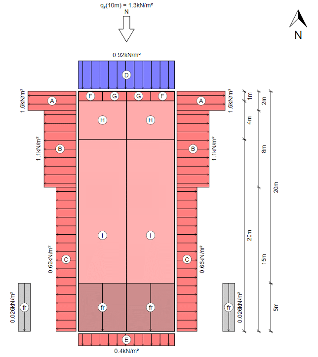
PolyWind can calculate wind loads on the most common Eurocode buildings. It determines the shape coefficients based on the entered building geometry. And selects the peak velocity pressure for each facade and gable. PolyWind creates a nice visual representation of the wind loads in each direction. This allows for easy validation and further calculations.
Design steel-, timber-, and concrete columns with biaxial bending using PolyColumn.
Follow PolyStruc on LinkedIn for regular news and updates.
© 2025 PolyStruc